RAEON has supported several projects related to shoreline change in the Great Lakes, including a study using artificial vegetation to protect shorelines by reducing the impacts of waves and wakes. RAEON also supported a project to measure the evolution of Point Pelee National Park and to identify sediment transport pathways and potential mitigation strategies to protect critical ecosystems within the park. Funded by Mitacs, a nonprofit national research organization, results suggest that the eastern shoreline is moving inland, or transgressing, at a rate of more than 1 meter per year and that barrier breaching threatens inland marsh systems. Breach initiation, expansion, and closure is a self-reinforcing cycle that promotes fill-in processes, even during high lake levels, and increases the barrier width and resiliency in response to further lake level fluctuations.
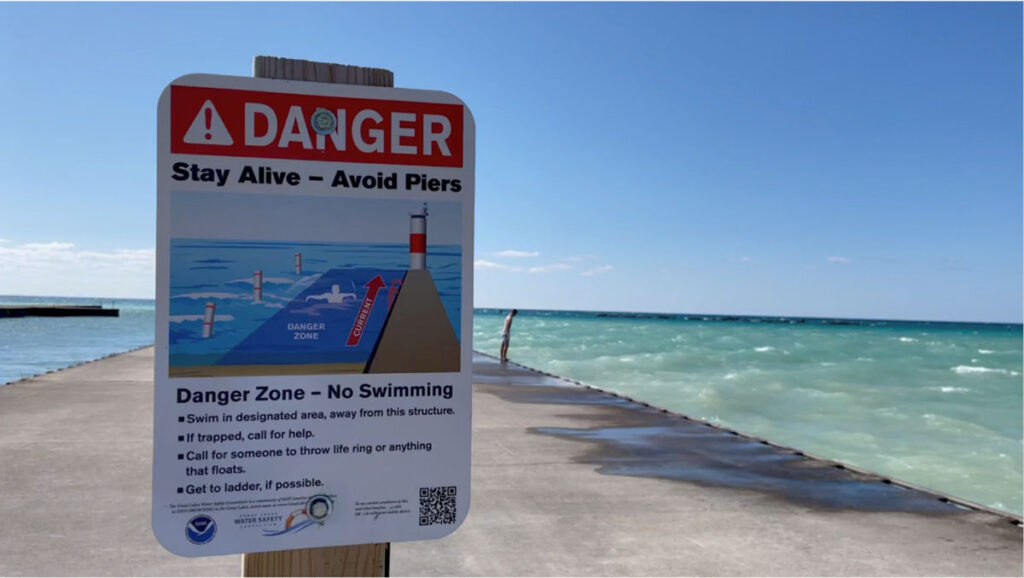
RAEON will also support a new Mitacs-funded Smart Beach project (2022-2025) in partnership with Bruce County and the Nuclear Innovation Institute that will include high-resolution wave and current measurement and modeling in Lake Huron. The University of Windsor’s Coastal Research Group will be implementing the Smart Beach project at Kincardine’s Station Beach on Lake Huron to promote beach safety and mitigate surf related hazards. Drowning fatalities on the Great Lakes are an emerging public health issue and represent a significant economic burden to the Province of Ontario. Smart Beach will provide a real time risk assessment to beach-users and will be used to create a dynamic warning system to inform the public and support first responders.
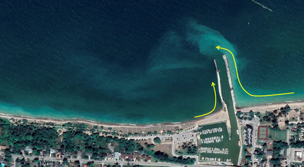
An integrated sensor network will be deployed on site that will measure beach-user activity, wave and weather conditions that can increase the risk of drowning and need for rescue. Anonymized beach-user densities and distributions will be monitored from beach cameras that can also detect the location of nearshore bar structures and the presence of stationary rip currents. An offshore buoy supplied by RAEON will measure wave, current, and weather conditions to determine the environmental factors responsible for increased beach hazards. These data will be used to calibrate wave and current models (MIKE21 and MIKE3) that will provide additional inputs to an artificial neural network (ANN) machine learning model designed to predict surf hazards covering the entire range of possible environmental conditions.
Measured and modelled surf conditions will be used to create a dynamic warning system through the development of beach signs and a web-based app that are continuously updated and will provide a spatially dependent risk assessment. To further promote beach-user safety, a series of community-based surveys and workshops will ensure the effective communication of risks are provided to the public. Ultimately, the goal of Smart Beach is to provide a scalable and adaptable warning system to enhance beach safety and lessen the risk of drownings on Station Beach and across the Great Lakes region.